After months of negotiations, consensus was finally reached over the weekend on the Habitat III outcome document.
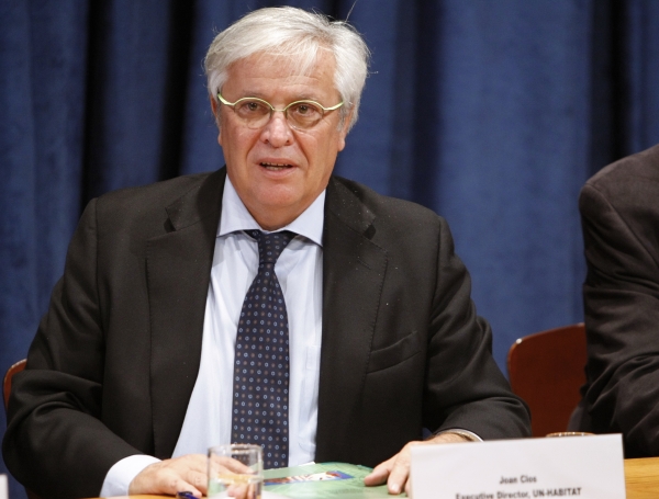
Joan Clos, Executive Director, UN-Habitat and Secretary-General of the Habitat III Conference. The New Urban Agenda will be adopted at the summit in October in Quito, Ecuador
Indeed, the New Urban Agenda was agreed on at the Habitat III Informal Intergovernmental Meetings which took place at the United Nations (UN) Headquarters in New York from 7 to 10 September. It will be adopted in Quito, Ecuador, in October 2016.
The New Urban Agenda is coming on the heels of the Surabaya Draft of the New Urban Agenda that was released at the third session of the Preparatory Committee for the Habitat III Conference in Surabaya, Indonesia in July 2016.
“Reaching an agreement on the New Urban Agenda is a huge first step towards a shared vision on sustainable cities and a historic opportunity to work together on improving the way we plan and manage our cities. Member states and stakeholders have committed to this collective vision, and it is something truly worth celebrating,” says Dr Joan Clos, Secretary-General of the Habitat III Conference.
According to him, the Quito forum will be a global arena for active discussions, the creation of new pathways in response to the challenges of urbanisation and opportunities, and sharing integrated urban solutions and forging new partnerships towards the New Urban Agenda.
As the century is projected to see a substantial majority of the world’s population living in urban centres, the Habitat III Conference has, as its mission, the adoption of a New Urban Agenda, which promoters of the event describe as “an action-oriented document which will set global standards of achievement in sustainable urban development, rethinking the way we build, manage, and live in cities through drawing together cooperation with committed partners, relevant stakeholders, and urban actors at all levels of government as well as the private sector.”
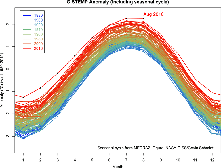
August 2016 was the warmest August in 136 years of modern record-keeping, according to a monthly analysis of global temperatures by scientists at the National Aeronautics and Space Administration’s (NASA) Goddard Institute for Space Studies (GISS) in New York.
August 2016 emerges a record month. Credit: NASA’s Goddard Institute for Space Studies
NASA is an independent agency of the executive branch of the United States federal government responsible for the civilian space programme as well as aeronautics and aerospace research.
Although the seasonal temperature cycle typically peaks in July, August 2016 wound up tied with July 2016 for the warmest month ever recorded. August 2016’s temperature was 0.16 degrees Celsius warmer than the previous warmest August in 2014. Last month also was 0.98 degrees Celsius warmer than the mean August temperature from 1951-1980.
“Monthly rankings, which vary by only a few hundredths of a degree, are inherently fragile,” according to GISS Director, Gavin Schmidt. “We stress that the long-term trends are the most important for understanding the ongoing changes that are affecting our planet.”
The record warm August continued a streak of 11 consecutive months dating back to October 2015 that have set new monthly high-temperature records. The monthly analysis by the GISS team is assembled from publicly available data acquired by about 6,300 meteorological stations around the world, ship- and buoy-based instruments measuring sea surface temperature, and Antarctic research stations. The modern global temperature record begins around 1880 because previous observations didn’t cover enough of the planet.
Across the globe, nations have kick-started a new and exciting development agenda aimed at ending poverty and reducing risks linked with climate change, pollution and over-exploitation of the natural environment. This journey to a brighter, more prosperous and resilient future has been forged through two powerful and mutually re-enforcing pathways – the Paris Climate Change Agreement and the Sustainable Development Goals of 2015.
Patricia Espinosa, United Nations (UN) Under-Secretary General and the Executive Secretary of the UN Framework Convention on Climate Change (UNFCCC), and Salaheddine Mezouar, President of the upcoming 22nd Conference of Parties (COP22) and the Minister of Foreign Affairs and Cooperation of the Kingdom of Morocco, in this jointly-written article published in the Green Africa Directory, explore the prospects of green growth on the continent in the light of the upcoming global summit
Patricia Espinosa, Executive Secretary of the UNFCCC, and Salaheddine Mezouar, President of COP22, insist that Africa is at the dawn of an unprecedented evolution and that a green growth model will give it an advantage on global markets
The prospects for success are high, since the involvement of all stakeholders is strong: All countries large and small, East and West, North and South are on board and fully committed in global negotiations, with the historical adoption of the Paris Agreement by 195 countries and the submission of Intended Nationally Determined Contributions (INDCs).
Many non-state actors – cities, regions and provinces, businesses and investors – have joined the journey via individual commitments or cooperative initiatives many of which are referenced on the NAZCA platform (~12,000 commitments and 77 collaborative initiatives).
France and Morocco’s global climate champions have set out the Global Climate Action Agenda to boost cooperative action between governments and non-state actors in order to support and catalyse early and effective implementation of the Paris Agreement.
However, the work is just starting and many challenges lie ahead.
The pledges made will not limit global warming to 2°C. The consequences of global warming will be dire for agriculture and water supplies and threaten the most vulnerable regions and their populations. Governments need to raise their INDCs and make concrete, realistic plans to back up their national pledges.
Countries need to translate their INDCs into investible programmes through greater access to finance, adaptation of policy frameworks and better project planning. The involvement of non-state actors could be further strengthened, especially on investments, capability building and technology transfer.
Africa is at the dawn of an unprecedented growth. As outlined by the Africa Progress Panel, the continent has the opportunity to choose a model for its industrialisation. A “green growth” model that would draw on its vast renewable resource potential to build its economic growth would certainly give it an advantage on global markets. Similarly, the African Development Bank’s report on green growth highlights that this transition contributes to creating a “higher quality” of growth: more resilient and more inclusive. Africa’s biggest opportunities lie in energy, city planning and urban mobility, as well as agriculture and land use, all sectors facing major choices for their development. “Green growth” for Africa will materialise through:
Increasing access to clean, modern sources of energy. Over 620 million people in sub-Saharan Africa alone lack access to electricity. They are forced to rely on charcoal, kerosene, candles and torches that harm both their health and the environment and are unaffordable for the most vulenrable (most vulnerable households spend 20 times more than rich urban citizens for the same amount of energy, as they rely on biomass or costly oil-based generators). Development increasingly based on renewable energies in Africa (from 26% à 32% of energy production) is becoming increasingly competitive. Moreover, regional integration would allow to reduce costs even more through scale effect and better optimisation.
Develop resilient and inclusive cities. Because Africa is the fastest-urbanising continent in the world, the consequences of climate change on cities will be enormous, especially for their poorest inhabitants. The urban population of Africa is estimated to rise from its current level of 472 million to 659 million by 2025, and 1 billion by 2040, driving most of the economic growth on the continent. Yet, African cities cannot absorb the growth of their population because of the lack of urban planning, mass transportation systems, affordable housing and waste management systems. Weak institutions and widespread insolvency of African cities are adding additional constraints to the development of cleaner and more resilient cities. The urban poor are particularly vulnerable to climate change impacts, as they often live in highly exposed or at-risk areas (wetlands, floodplains, landfills, garbage dumps, rocky areas).
Boosting the resilience and productivity of agriculture. Warming of 3°C-4°C above pre-industrial temperatures will heighten the risk of extreme drought (particularly in southern Africa), decrease the yields of major staple crops by 20% and threaten water availability. Agricultural techniques, e.g., water storage, drought-resistant crops, crop rotation and flood protection, must be improved to make agriculture more resilient to climate change and reduce food loss and waste. Increasing the productivity of agriculture will also reduce deforestation, 70% of which is caused by agriculture.
Multiple global and regional initiatives are underway to tackle Africa’s big challenges:
Energy. The African Development Bank’s New Deal on Energy for Africa is a major initiative to coordinate efforts of all stakeholders on energy in Africa. Other initiatives aim to achieve universal energy access and scale up the use of clean energies include the UN’s Sustainable Energy for All (SE4All) and the Africa Renewable Energy Initiative (AREI), launched at the Paris conference. Governments can attract private investors by helping national players to develop bankable, scalable projects and introducing favourable regulation frameworks.
Cities and urban mobility. International initiatives such as the C40 Climate Leadership Group and the Compact of Mayors focus on helping African cities to develop urban planning and mass transit systems. The main challenge is to integrate Africa better into these initiatives as activities become more scalable.
Agriculture. Initiatives such as the Global Alliance for Climate Smart agriculture aim at sustainably increasing agricultural productivity and incomes, adapting and building resilience to climate change, and reducing greenhouse gas emissions.
Providing a forum to mature, scale up and fast track existing projects and establish new ones to realise the Paris Agreement and the SDGs, especially in those sectors that are crucial to African development in particular.
Linking projects with support on enablers specified in the Paris Agreement, particularly access to finance (to bridge the $55 billion yearly financing gap for Africa by 2030) capability building and technology transfer.
Marking the beginning of a new generation of COP focused on actions to implement the Paris Agreement.
The COP22 is important for Africa’s city and regional leaders, CEOs and investors. They will witness first-hand the risks and opportunities of taking action nationally and internationally and be able to signal their solidarity with the continent’s governments and citizens.
We look forward to exchanging ideas and working together for a better future. This is an imperative for the World’s seven billion strong population and for future generations.
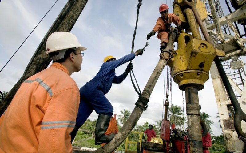
Following recent earth tremors in some parts of the country, some scientists have warned that earthquakes can be triggered by oil and gas exploration, especially in the Niger Delta region.
Oil exploration
The News Agency of Nigeria (NAN) spoke with some scientists and stakeholders across the country recently against the backdrop of earth tremors in some states which has caused widespread panic and a cause for concern.
Most of the respondents warned that the country could be vulnerable to earthquakes and other seismological activities, said could be triggered by the oil and gas exploration, among other human activities.
NAN recalls that earth tremors caused a wide spread panic among residents of the affected communities of Akenfa and Igbogene in Bayelsa State, and Akinima, Akieoniso (Oruama) and One Man Country and Mbiama in Rivers State.
Tremors also happened many times in Saki, located in the northern part of Oyo State – a hilly town that lies near the source of Ofun River, which is about 60km to the Republic of Benin border.
The National Space Research and Development Agency (NASRDA) said that oil and gas exploration as well as human activities among others were the likely causes of tremor in the South South.
According to the Deputy Director, Media and Corporate Communications, of NASRDA, Mr Felix Ale, the organisation had done a preliminary report on the suspected earth tremors that occurred in July 15 and July 24 in Bayelsa and Rivers states respectively.
“The report shows that oil and gas exploration, suspected suture zones, and man-made activities are among likely causes of the incidents.
“At this stage, it cannot be concluded that the tremors occurred as a result of manmade activities in the region or from tectonic activities from natural sources until a detailed investigation in the entire South-South region is carried out by NASRDA’s research team.
“The detailed analyses by the team will help the agency to adopt requisite mitigating measures to avert loss of lives and property in case of future occurrences.
“In view of the nature of earth tremors or earthquakes, especially natural tremors, the Space Agency is making plans to deploy monitoring seismic equipment to the affected region for continuous micro seismic and macro seismic activities.
“This is imperative because tremors will continue to occur in the future, depending on either natural or artificial causative agents.
“Scientists from the Centre for Geodesy and Geodynamics, Toro (Bauchi State), under NASRDA, are currently working on relevant seismic data to extract more information from seismic station located in Toro,” he said.
Ale said that the scientists would also embark on a field trip to Kaduna, Ife and Abakiliki stations to acquire more data from the stations, saying comprehensive results from the detailed analysis would be made available in due course.
The agency said that similar tremor was observed at Saki, Oyo State, in May, which also sent residents of the area scampering for safety.
The agency said a team of researchers were immediately deployed to the affected areas and intensity was estimated as MM III-IV and local magnitudes as 2.5 to 3.0.
“Report on Saki incident has been submitted to the Space Agency for further studies,’’ Ale said.
NASRDA enjoined citizens of affected areas and indeed the general public to remain calm as all scientific measures were currently being deployed to ascertain the causes of the earth tremors for possible mitigating measures.
“This is to avert loss of lives and property in case of future occurrences,” Ale said.
A scientist and Director, Technology Acquisition and Adaption Federal Ministry of Science and Technology, Dr Adeneye Talabi, also attributed the incident of earth tremors to exploration of oil and gas.
Talabi said that the Federal Government needed to save more lives by enforcing all existing rules on exploiting natural resources.
Talabi said that the government should ensure due processes were followed to address tremors that occurred recently in the South-South region.
He said that the balance of the ecosystem had been distorted by the fact that oil had been extracted, adding that the vacuum created by extracting gas and crude oil ought to be replaced with close density commodity to avoid any future disaster.
“There is need for the Federal Government and the Nigerian National Petroleum Corporation, in particular, to enforce all the existing and rules guiding exploitation of natural resources like crude oil.
“Regarding the tremor at Bayelsa and Rivers, the fact that they have been extracting through the exploitation processes and methods, vacuum has been created, “ he said.
He explained that Nigeria was not immune naturally against such occurrence, adding that every appropriate measures ought to be put in place to avert them in future.
He said that the country needed to carry out world best practices in the processes of extracting natural resources such as petroleum and natural gas.
“As a reasonable people, we should not allow the level of calamity that the Indonesia experienced which led to their tsunami.
“If there is a tremor, it is giving us sign indication, or symptom that the eventual higher degree of it which will translate into earthquake can occur.
“Earth tremor is more closely associated to earthquake. The earth tremor is just the shaking of the ground earth thrust while earthquake is a total collapse or opening up of the ground,” he said.
A geologist, Dr Emmanuel Adanu, the Executive Director, National Water Resources Institute, Kaduna, said Nigeria needed to be keeping records of the various earth tremors in the country to prepare ahead of future tremors in the country.
Adanu said that the country used to have some equipment that could help in that direction but some of them were no more functioning.
“We have some of them in Zaria but are no more functioning,” he stated.
According to him, tremors are products of certain natural actions like earthquake and volcano.
Adanu said: “Nigeria is not actually a tremor-prone nation but due to earthquake in the mid-Atlantic Ocean and volcano in some mountains around the country, some parts of the country may experience tremors occasionally.’’
He said that some parts of South-West like Ibadan and Abeokuta might experience tremor due to volcano in the middle of the Atlantic Ocean.
“If there is severe volcano in the middle of the Atlantics, the tremor will converge through those perpendicular lines and you can have tremor in Abeokuta, Ibadan or the South West Nigeria.
“In the Jos Plateau, if the volcano becomes active, you can have tremor, in Bauchi, and Biu. So in Nigeria, we need to have proper record of them.
“If there are volcanic activities in Cameroonian mountain, it can lead to tremor in some parts of Taraba State,” he said.
Adanu said that his organisation was doing some investigations to actually find the likely cause of tremor in Rivers and Bayelsa states, adding that volcanic activities around Benue trough could cause volcano in South-South region.
An environmentalist, Mrs Grace Martin, urged the country to mainly focus on agriculture by totally shifting attention from oil exploration.
Martin said that shifting attention from crude oil was necessary to avert likely major earthquake that could follow earth tremors being experienced in some places in the country.
“The tremor is created by us. It is an artificial tremor because anywhere you keep on drilling constantly looking for oil; you damage the base of the land itself.
“You have to crack the soil before you can be able to extract the crude oil.
“We did not have tremor before because there was not so much exploration of crude oil, ‘’ she said.
She appealed to the Federal Government to discourage other states from trying to search for crude oil to deviate from such.
According to her, the reason China that has plenty oil does not explore it to make money is just to avoid problems of tremor and earthquake.
She said that the international communities were refraining from buying crude oil but now focusing on biogas, solar energy and wind energy.
“I will advise Federal Government to be honest and look inward to fully embark on agricultural projects on ground so that we will not be where we don’t to be.
“Look at what happened in Thailand, Japan and Indonesian recently. In the next 15 years, if care is not taken, we may have a major earthquake in Nigeria.
“Talking about the ecosystem, we don’t need that now, we cannot avoid the repercussion and the level of disasters that can happen to our people,’ ’she said.
However, an architect, Mr Samuel Martins, said that exploration, drilling of boreholes and other mining activities could not cause earth tremor as was being alleged in some quarters.
Martins, who works with Computer Aided Design and Drafting (CADD) told NAN that although such human activities would not cause earth tremor, it was necessary to have in place a technology to determine when to continue or stop such activities.
He said that the earth tremor is not a sudden development but a situation that gradually moves to its climax.
Martins, however, said that there was need to deploy modern technology to assess geographical locations and measure their safety to human existence.
He identified the lack of such technology as a challenge in most developing countries; a situation he said would further compound such issues.
“In this side of the world, one of the problems we have is that we don’t have machines and computers in place that can measure this type of tremor before they happen.
“The one that happened in Asia recently, that was a 7.0 earthquake, they knew to an extent before it happened.
“There are machines in place that can measure the size of tremor or earthquake, but we don’t have that,” he said.
He said that it was regrettable that most times actions were taken after disaster would have occurred.
He therefore called on the Ministry of Environment to acquire technologies that would identify and prepare people that could be exposed to such disasters.
Martins maintained that there was need to know the size of such tremor in order to identify its type.
Bayelsa and River state have also had their fair share of the earth tremor menace, which is increasingly giving the nation a cause for concern.
Several cities in Nigeria have experienced earth tremor
A couple of months ago, tremors in parts of the two oil-rich states reportedly caused palpable apprehension among residents of affected communities.
Residents of the areas noted that the tremors caused serious cracks on the walls of their buildings though no injury was reported.
It was learnt that, in some of the impacted communities such as Igbogene and Akenfa in Bayelsa as well as Akinima, Akie-Oniso (Oruama), One Man Country and Mbiama – neighbouring communities in Rivers, many people who experienced it took some time to recover from the trauma.
According to them, there were heavy vibrations that lasted for some minutes during the incident which was said to have started at about 12 midnight.
A retired Principal and landlord in Igbogene, Bayelsa State, Chief Etekpe Friday, described the experience as “frightening”.
“We were about to go to bed when I heard a heavy vibration. I thought it was something else so I quickly went into prayers,” the 60-year-old man stated.
Another resident, Victor Idieto, described the earth tremor as a kind of earthquake.
He said, “In fact, there was a kind of earthquake, very serious quake that lasted for some minutes.
“At first, I thought it was armed robbers that were removing my roof, so I started shouting, ‘armed robbers, armed robbers’, only to realise that others had similar experience.”
At Akie-Oniso(Oruama) in Ahoada West Local Government Area of Rivers State, a resident, Paul Kio, said the tremor caused a serious crack in his building.
“This vibration was something unpredictable, look at the cracks on my wall,” Kio explained.
Also, Paul Harrison, who hails from Delta State, but resides in the area, said it was the fourth time the incident had taken place, vowing to take his family away from the community if another occurred.
The story was the same at Akinima, headquarters of the LGA. A house wife, Animason Emeka-Mark, pointed out that she had a traumatic feeling throughout the fateful night.
“Everywhere was shaking. It was something else. I thought the world had come to an end,” she said.”
Officials of the environment based non-governmental organisation, Environmental Right Action and Friends of the Earth in Nigeria, Bayelsa State chapter, who were also on an assessment tour of the affected areas, said that was not the first vibration experienced.
ERA/FoEN coordinator in Bayelsa, Mr. Alagoa Morris, said the last occurrence took place two years ago in Freetown, Ikarama 1 & 2 in Okordia clan in Yenagoa LGA.
He said that though what could have triggered the tremor had yet to be established, some indigenes and environmentalists had linked it to intense seismic and oil exploration activities undertaken by multinational companies in the area over the years.
Morris, therefore, called on the government and relevant agencies to look into the incident with a view to ascertaining the real cause and prevent future occurrences to avert any disaster.
Although Nigeria is not located within the major seismic zones of the world; over the years, several minor earthquakes have been experienced in some parts of the country.
Earthquake
Seismic events had been recorded instrumentally and also historically from 1933 to 2011 in Nigeria. The first widely reported occurrence of an Earth tremor in Nigeria was in 1933. Other events were reported in 1939, 1964, 1984, 1990, 1994, 1997, 2000 and 2006. The intensities of these events ranged from III to VI based on the Modified Mercalli Intensity Scale. Of these events, only the 1984, 1990, 1994 and 2000 events were instrumentally recorded.
These pockets of activities were felt in different parts of the country with the southwest region recording the highest number of events and moderate magnitudes of between 4 and 4.5.
They had body wave magnitudes ranging from 4.3 to 4.5, local magnitudes between 3.7 and 4.2, and surface wave magnitudes of 3.7 to 3.9.
The geology and the structural tectonic setting of the region in question are the probable mechanisms that are responsible for the observed and recorded events in Nigeria.
When these events occurred, there were no functional seismological observatories in Nigeria. However, that has now changed with the establishment of a seismographic network managed by the Centre for Geodesy and Geodynamics (CGG), Toro, Nigeria.
In 2006, the Centre for Geodesy and Geodynamics in Toro took over the management of the Nigerian National Network of Seismographic Stations (NNNSS) established by the National Agency for Science and Engineering Infrastructure (NASENI).
Presently, the network has four operational stations equipped with 24-bit 4-channel recorders and broadband 30-second seismometers. Efforts are being made to establish more stations and migrate to real-time collection of seismic data using the general packet radio service (GPRS) technology as well as automatic location of events.
Effort to increase the number of stations has reached an advance stage. The Centre also intends to modify the monitoring framework to collocate with Continuously Operating Reference Stations (CORS), Global Positioning System in the exiting five stations and the proposed additional one station.
Remote sensing, geological and geophysical studies have revealed the presence of a NNE-SSW trending Ifewara-Zungeru fault zone which has been shown to be linked with the Atlantic fracture system. The dynamics of the Atlantic fracture zones have been suggested to be responsible for the seismic activities experienced in the areas.
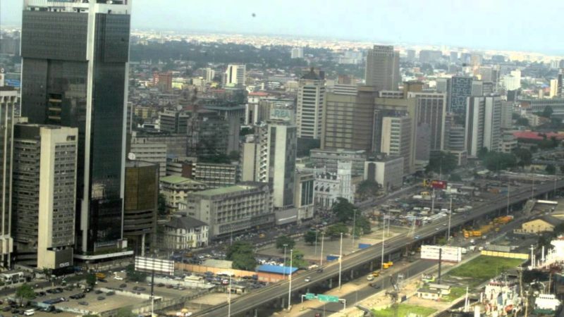
Six states have been named as possible sites for devastating earthquakes before 2020. They are Lagos, Bayelsa, Oyo, Rivers, Cross River and Delta.
A view of the Lagos Marina. Experts have listed Lagos, Oyo and several others among states prone to earthquake
However, Kaduna State, which has of recent experienced series of earth tremors, is not lincluded in the list.
Researchers from the Department of Geology, Obafemi Awolowo University (OAU), Ile-Ife in Osun State, led by Dr Adepelumi Adekunle Abraham, warned in a report titled “Preliminary Assessment of Earth Tremor Occurrence in Shaki Area, Shaki West Local Government, Oyo State” of an impending “damaging earthquake” in the next four years.
The study was informed by an earth-moving tremor that occurred at Shaki town, in the Shaki West Local Government, Oyo State.
The report stated: “After the earth tremor of 2009 in southwestern Nigeria that was felt in several towns and villages in Oyo, Osun and Ogun states, a detailed short-term probabilistic earthquake prediction was carried out by our team, our findings indicate the probability of earthquake occurrence in the study area between the year 2009 and 2028 increased from 2.8 per cent to 91.1 per cent.”
The areas flagged by the report with the possibility of experiencing earthquake disaster are:
Lagos, Port-Harcourt in Rivers State, Warri in Delta State, Bayelsa State, Cross River State and Oyo State.
Meanwhile, the Nigerian Association of Water-Well Drilling Rig Owners and Practitioners (AWDROP) has called on the Federal Government to take measures that could reduce the effects of earthquake as the states exist at the risk of possible earthquake.
National President of AWDROP, Mr. Michael Ale, lamented that lack of Underground Water Abstraction Regulation in Nigeria could easily induce earthquake and sea water intrusion, “hence the need for government to ensure strict compliance in the implementation of code of practice in borehole drilling” in the country.
Ale said his association had been informed of the salt water intrusion affecting underground water usage and subsidence along the land-ocean boundaries in shoreline areas.
Many residents of Sambang Dagi in Jaba Local Government Area (LGA) of Kaduna State have been displaced as a result of earth tremors felt in the area.
From Left: Kaduna State Governor, Mallam Nasir El-Rufai. speaking to the press. He has urged residents of communities affected by the earth tremors to remain calm. Photo credit: Bayoor Ewuoso
According to the News Agency of Nigeria (NAN), the first tremor happened at Nok village about 20km away from Sambang, and another was felt in the early hours of Monday.
The residents were reportedly thrown into state of shock when the incident took them unawares around 4am.
Details of damages or any loss of live was still sketchy as of the time of filling this report.
Nasir el-Rufai, governor of the state, has urged residents of the affected communities to remain calm.
He said this in a statement issued on his behalf by Sam Aruwan, his spokesman.
The statement said the government had made a formal report to the appropriate authorities to investigate the development and report on the event for appropriate guidance.
“The Governor, Malam Nasir Ahmad El-Rufai, has confirmed that the geological and emergency agencies have been notified.
“The governor sympathises with the people in the Kwoi area over the reported earth tremors. He has directed the State Emergency Management Agency (SEMA) to mobilise to the area and comfort our citizens.
“The national geological agency has also been notified, and has been invited to investigate the tremors in the Kwoi area and provide appropriate guidance.
“The Kaduna State Government is receiving updates from the area,” the statement read.
“Relevant government agencies have been directed to take steps to comfort the residents of Kwoi area and to assuage their unease as they come to terms with an unusual event.
“The Kaduna State Government wishes to appeal for calm, and urges everyone not to spread unverified information, or create panic.”
Just days ago, precisely from Sunday morning till about 2pm, Kwoi town in Jaba local government area of the state was hit by a tremor. The strange vibration of the earth and deafening sounds created panic as residents were forced out of their homes.
An eye witness, Suleiman Yakubu, who is a journalist, said of the incident: “Though people have not started fleeing the community but, as I talk to you, there is tension. Everyone is standing outside as the earth is vibrating under their feet. It started since morning and if it continues like this till evening, people will have no choice than to leave the town to safer places.”
Another eyewitness, Badugu Nehemiah, a politician, said: “Since morning, many people in our villages have been running up and down, because both buildings and the ground have been shaking. Many churches had to cut short their Sunday service programmes because of the earthquake threat. As I am speaking with you, the ground is still shaking.”
And, about four months before the Kwoi tremor, Ikara town in the same Kaduna State also experienced a tremor that sacked hundreds of households.
A few days ago a 5.8 earthquake in Tanzania killed about 15 people and injured over 200 others; while another quake which struck in Italy late last month killed close to 300 people and caused extensive damage.
The US government on Friday temporarily blocked construction on part of a North Dakota oil pipeline, an unusual intervention in a prairie battle that has drawn thousands of Native Americans and activists to camp and demonstrate.
Dakota Access pipeline protest in North Dakota. Photo Credit: “No Dakota Access in Treaty Territory – Camp of the Sacred Stones”
In announcing the pause, the government acknowledged complaints from the Standing Rock Sioux and other tribal nations that their concerns had not been fully heard before federal overseers approved a pipeline that the tribe said could damage their water supplies and ancestral cultural sites. The Justice Department and other agencies called for “serious discussion on whether there should be nationwide reform with respect to considering tribes’ views on these types of infrastructure projects.”
The tribe in a statement called the federal order “a game changer.”
The government’s move, announced minutes after a federal judge rejected efforts by the Standing Rock Sioux to block construction of the project, appeared to seek to ease tensions and reset the terms of a passionate debate that has cast the 1,170-mile Dakota Access pipeline either as an economic boon for the Plains or a threat to Native American sovereignty, waters and lands. But perhaps more significantly, it appeared to signal a broader willingness to re-examine the involvement of the tribes in infrastructure decisions like this one.
The government said it would invite tribes to attend formal consultations about how they might work together on federal decisions on tribal lands and on whether future legislation is needed.
In recent days, protesters have clashed with the pipeline company’s contractors and private security guards, and officials in North Dakota have stepped up patrols and warned of rising tensions as ranchers, sheriff’s officers, tribal leaders and protesters waited for a ruling on the Standing Rock Sioux’s federal lawsuit to block construction on the pipeline.
In a joint statement from the Departments of Justice, the Interior and the Army, the government announced that the pause applied to the pipeline’s path across a sliver of federal lands and under a dammed section of the Missouri River known as Lake Oahe. The lake, created by government-built dams a half-century ago, is a water source for the Standing Rock Sioux and a focal point of the dispute.
The Army Corps of Engineers intends to review its previous decisions under federal environmental and other laws that had given approval for the pipeline. The government also urged the company building the pipeline to “voluntarily pause” all construction for 40 miles around Lake Oahe. The rest of the pipeline construction would not be affected.
Tribal leaders said they were heartened by the government’s move and relieved that, for the time being, the Dakota Access pipeline would not be allowed to cross under their water supply. “When there’s a wrong that keeps continuing to happen, it’s O.K. to stand up against that wrong. That’s all we did,” said David Archambault II, the chairman of the Standing Rock Sioux. “I’m just so thankful that agencies are starting to listen.”
For supporters and opponents of the pipeline, it was a day of high-tension whiplash.
The tribe had been bracing for a defeat in the courtroom. But the government’s intervention surprised so many that the tribe and its supporters sent out news releases condemning the ruling as soon as it was handed down, and sharply reversed course once they realized that the government-ordered pause had scrambled the situation here.
Craig Stevens, a spokesman for the MAIN Coalition, a pro-infrastructure group supporting the pipeline, hailed the judge’s decision, but said the government’s move was “deeply troubling and could have a long-lasting chilling effect on private infrastructure development in the United States.”
“Should the administration ultimately stop this construction, it would set a horrific precedent,” Mr. Stevens said in the statement. “No sane American company would dare expend years of effort and billions of dollars weaving through an onerous regulatory process receiving all necessary permits and agreements, only to be faced with additional regulatory impediments and be shut down halfway through completion of its project.”
Activist Howard Ehrman said: “This important victory only happened because of the unity, strength and solidarity of Native Americans in lifting up the rights of Mother Earth including the sacredness of water and taking direct action.”
The company behind the pipeline, Energy Transfer Partners, did not respond to a request for comment.
It was unclear whether the company would heed the government’s request to pause construction 20 miles to the east and west of Lake Oahe. After protests swelled recently and flared into violence last Saturday, construction work was halted near the site of the protest camp and the fields about a mile up the road where the pipeline is set to be buried.
The company has previously said it has complied with every state and federal rule and gotten all the necessary permits to build the $3.7 billion pipeline. It has said the Dakota Access pipeline would create jobs, pump millions into local economies and provide a reliable way to transport oil from western North Dakota to pipeline networks in Illinois that was safer than hauling oil on trucks or trains.
In his ruling, Judge James E. Boasberg of Federal District Court in Washington focused on efforts by the Army Corps to meet with the Standing Rock Sioux and others to work through possible issues with the pipeline, since “the Corps appears to have had little involvement in Dakota Access’s early planning,” the judge wrote, but “The writing was on the wall, however, that many DAPL permitting requests would eventually land in the Corps inbox.”
The judge described a series of attempted meetings and missed communications between government and tribal officials; the judge suggested that the lack of cooperation was mostly on the part of the tribe, while “the Corps has documented dozens of attempts it made to consult with the Standing Rock Sioux from the fall of 2014 through the spring of 2016” on the pipeline plan.
Two days after the Corps approved what are known as preconstruction notifications on the pipeline, the tribes filed suit demanding that the permits be withdrawn.
The judge said the efforts to obtain cooperation from the Standing Rock tribe were exhaustive, with dozens of attempts documented by the Corps to bring them to the table for discussion of Lake Oahe and other points of water crossings. The judge then wryly added: “To the reader’s relief, the Court need not repeat them here. Suffice it to say that the Tribe largely refused to engage in consultations.”
The meetings that the Corps was able to arrange, he wrote, “sufficed” under the law.
“Today’s news is a stunning development,” said Jan Hasselman, a lawyer with Earthjustice, an environmental legal group that is representing the Standing Rock Sioux. “It vindicates what the tribe has been saying form the beginning: The process was wrong, and the legal standards for projects like these need reform.”
It was unclear on Friday how long the government-ordered pause in construction around Lake Oahe might last, or whether the move had given the Standing Rock Sioux any greater odds of prevailing. But on Friday morning, tribal members said they had lived on the land for generation upon generation, and were prepared to stay through the fall, the winter and beyond.
“They’ll be here for years,” said Jana Gipp, a member of the Standing Rock Sioux, as she surveyed the camp’s tents and teepees from a grassy bluff. “They won’t give this up.”
By Jack Healy and John Schwartz (The New York Times)
Joint Statement from the Department of Justice, the Department of the Army and the Department of the Interior Regarding Standing Rock Sioux Tribe v. U.S. Army Corps of Engineers
The Department of Justice, the Department of the Army and the Department of the Interior issued the following statement regarding Standing Rock Sioux Tribe v. U.S. Army Corps of Engineers:
“We appreciate the District Court’s opinion on the U.S. Army Corps of Engineers’ compliance with the National Historic Preservation Act. However, important issues raised by the Standing Rock Sioux Tribe and other tribal nations and their members regarding the Dakota Access pipeline specifically, and pipeline-related decision-making generally, remain. Therefore, the Department of the Army, the Department of Justice, and the Department of the Interior will take the following steps.
The Army will not authorize constructing the Dakota Access pipeline on Corps land bordering or under Lake Oahe until it can determine whether it will need to reconsider any of its previous decisions regarding the Lake Oahe site under the National Environmental Policy Act (NEPA) or other federal laws. Therefore, construction of the pipeline on Army Corps land bordering or under Lake Oahe will not go forward at this time. The Army will move expeditiously to make this determination, as everyone involved — including the pipeline company and its workers — deserves a clear and timely resolution. In the interim, we request that the pipeline company voluntarily pause all construction activity within 20 miles east or west of Lake Oahe.
“Furthermore, this case has highlighted the need for a serious discussion on whether there should be nationwide reform with respect to considering tribes’ views on these types of infrastructure projects. Therefore, this fall, we will invite tribes to formal, government-to-government consultations on two questions: (1) within the existing statutory framework, what should the federal government do to better ensure meaningful tribal input into infrastructure-related reviews and decisions and the protection of tribal lands, resources, and treaty rights; and (2) should new legislation be proposed to Congress to alter that statutory framework and promote those goals.
“Finally, we fully support the rights of all Americans to assemble and speak freely. We urge everyone involved in protest or pipeline activities to adhere to the principles of nonviolence. Of course, anyone who commits violent or destructive acts may face criminal sanctions from federal, tribal, state, or local authorities. The Departments of Justice and the Interior will continue to deploy resources to North Dakota to help state, local, and tribal authorities, and the communities they serve, better communicate, defuse tensions, support peaceful protest, and maintain public safety.
“In recent days, we have seen thousands of demonstrators come together peacefully, with support from scores of sovereign tribal governments, to exercise their First Amendment rights and to voice heartfelt concerns about the environment and historic, sacred sites. It is now incumbent on all of us to develop a path forward that serves the broadest public interest.”
Phivolcs cites ‘abnormal activity’ such as drying wells, more earthquakes, and increased sulphur dioxide emission of the volcano
The Mayon Volcano. Volcanologists say magma beneath the so-called ‘perfect cone’ is building up. Photo credit: Rhaydz B. Barcia/Rappler
Scientists at the Philippine Institute of Volcanology and Seismology (Phivolcs) have warned of a possible “big” Mayon volcano eruption in the coming days. The warning was issued at the weekend.
“Phreatic explosion may happen anytime but a big explosion is expected in the coming days,” said Philvolcs resident volcanologist Eduardo Laguerta.
Laguerta cited “abnormal activity” similar to what happened prior to the Mayon eruption in 1984.
The 1984 Mayon eruption is classified as a Vulcanian-type eruption which involves relatively small but violent explosions of thick lava producing columns of ash, gas, and occasional pyroclastic flows.
“The massive drying up of wells across Albay, specifically in the municipalities surrounding the volcano, may be attributed to the magma movement activity beneath the restive volcano,” Laguerta added.
He also cited the three consecutive earthquakes in August originating from the Sto Domingo fault line, which can affect volcanic activity.
Laguerta said his office asked geodetic engineers from the Phivolcs central office to conduct a ground survey around the volcano following the earthquakes.
“We noted after the survey, Mayon is inflated, magma beneath the volcano is building up. Deep wells are drying up surrounding the volcano and in several towns here – an implication of abnormal activity,” he said.
Magmatic eruption possible
Laguerta said that while magma build-up did not progress past the belly of the volcano during its explosion in 2014, a “magmatic eruption” may happen this time around.
“Today the possibility to continue for magmatic eruption is possible. We cannot discount the possibility of big explosion,” he said.
With these latest findings, Phivolcs raised Mayon to Alert Level 1.
According to a Phivolcs advisory, its monitoring showed the following:
Increased sulphur dioxide emission from the Mayon crater, or beyond the baseline level of 500 tons per day, even exceeding 1,000 tons per day on some days, since July 2016
Increased volcanic earthquake activity, with a total of 146 earthquakes recorded by the Mayon Volcano Observatory seismic network from August 3 to August 6 on the southeast side, 10 kilometers away from the volcano
Four of the 14 monitored water wells located on the southeastern side of Mayon are drying up, while one has completely dried up
Steam activity from the crater has ranged from weak to moderate, and no crater glow – which would indicate magma activity – has been observed. Even so, Phivolcs warned of a phreatic explosion anytime that could lead to a big eruption.
Rocks and steam are spewed out during a phreatic explosion.
Laguerta also reiterated the government’s warning for the public to stay out of the 6-kilometer danger zone, to avoid casualties.
In 1993, 77 farmers were killed, while several foreigners and their Filipino tourist guide were killed in phreatic explosions in 2013.
Cedric Daep, Albay Public Safety and Emergency Management Office (Apsemo) chief, said there are 18,000 people living along the slopes of the volcano.
Mayon has an elevation of 2,462 metres and is about 300 kilometers away from Manila. Its worst eruption was in 1814, which killed 1,200 people.